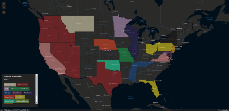
24/7 Supermarket Map
I created an interactive map displaying 24/7 supermarkets in the contiguous U.S.A. The goal of this project was to build a living supermarket map; users are expected to add/remove stores as needed. The application displays two layers: At the initial extent, the dominant (largest count) store determines the symbology of each state. Once the map is zoomed in, individual point locations of stores are displayed. Please feel free to contribute. This map, data and instruction on how to contribute can be found on GitHub.
What was used:
- ArcGIS API for Javascript 4.18
- GeoJSON
- GitHub
- Pandas & GeoPandas
- Python 3.9.7
How it works:
The ArcGIS API for Javascript drives the application. GitHub pages is used to host the application, data and execute a spatial join. Three GeoJSON layers are used: Stores.GeoJSON (point type), States.GeoJSON (polygon type), StatesCount.GeoJSON (polygon type). A spatial join occurs (to create the StatesCount.GeoJSON), whenever a store is added to the Stores.GeoJSON. GitHub actions executes this join by determining if the Stores.GeoJSON has been modified.