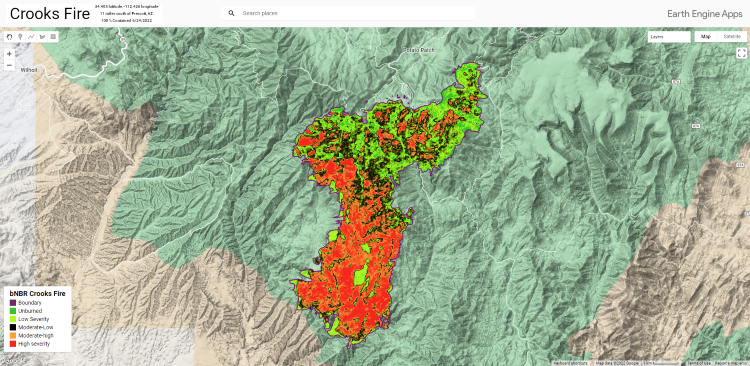
Crooks Fire dNBR - Google Earth Engine
Using Google Earth Engine, Landsat 9, and NIFC open data, I created an application to show the Normalized Burn Ratio (bNBR) of the Crooks Fire. The Crooks Fire began on 4/18/2022 which was located about 10 miles south of Prescott, Arizona. The fire was 100% contained as of June 24, 2022 which resulted in 9,402 acres of land burnt. The primary fules involved were: Timber(Litter and Understory), Chaparral, and brush. Officals believe the it was human-caused.
Methods and Instructions
If you're interested in replicating this work, read below. Learning and setting up Google Earth Engine was not as easy as I expected. However, if I wanted to replicate this application for other wildfires, it would be easy to do so. Why? Google Earth Engine's data catalog is ready and waiting. I've outlined the steps below and have shared my JS code. Note: you can also install GEE api in Python
- Create a Google - click "Sign Up" at the top right of page
- Navigate to Earth Engine Code Editor
- Create a new Cloud Project
- Write the Javascript....
- Some stuff you'll need to change:
- geojson boundary
- Landsat images
- Color scheme - I chose a color scheme which best represented my data
- Save and Run the Script
- Create the app
Here's the Javascript (you will need a Google Earth Engine account to view): https://code.earthengine.google.com/e996f1c586c4d5be9e163d73290e78fb
You can also GIT clone the repository:
git clone https://earthengine.googlesource.com/users/NevinMcIntyreGIS/LandsatComposite