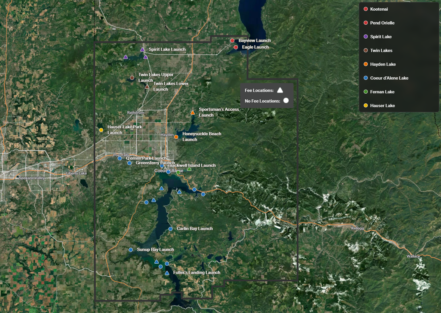
Kootenai County Boat Launch - Felt
Creating a project using the Felt platform has long been a goal of mine. To explore its potential, I crafted an uncommissioned boat launch map for Kootenai County, Idaho. Though the county didn't specifically request this, I envisioned it as a valuable addition to their existing boat launch landing page. I hope they'll consider integrating it. I envision Kootenai County utilizing the mapping application as a robust tool for enhancing communication and disseminating timely updates on boat launch facilities, such as closures, construction projects, and algae blooms. Furthermore, the platform's flexibility allows for the effortless integration of additional layers, providing even more comprehensive lake information.
I'm thoroughly impressed with Felt's capabilities and highly recommend it. The platform significantly simplifies the GIS expertise required for web map creation, making it accessible to almost anyone. Best of all, you can achieve this primarily without coding. Felt truly excels in facilitating collaboration—inviting team members to work on the map is seamless, and the editing process is intuitive. I'm thrilled to have mastered this versatile GIS tool and look forward to leveraging it for various applications.
Advantages with using Felt
- Collaboration
- Seamless updates to geospatial data enable near real-time information, facilitated by user input.
- Cartography made simple
- Redlining and markups
- Upload nearly everything
- QGIS plugin
- and more!
What was used:
- Felt
- GeoJSON