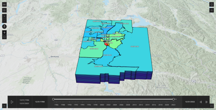
Kootenai County Census Tracts | FHFA House Price Index (HPI) | 1985-2022
I utilized a Space-time cube to display the House Price Index (HPI) over time within Kootenai County. The Space-time cube is an innovative geospatial analysis tool that combines spatial and temporal data, allowing us to visualize changes and patterns across both dimensions simultaneously. Instead of employing elevation as the third dimension, time is used, enabling a dynamic representation of HPI changes over defined locations within the county.
In my view, the most compelling use case for a Space-time cube lies in its ability to aggregate point data and create predictive hot spots. By aggregating points, we can efficiently analyze high-density areas and identify significant patterns within the data. My web application uses data with predefined locations, which provides valuable insights but does not fully showcase the potential of the Space-time cube.