Parkway dNBR - Google Earth Engine
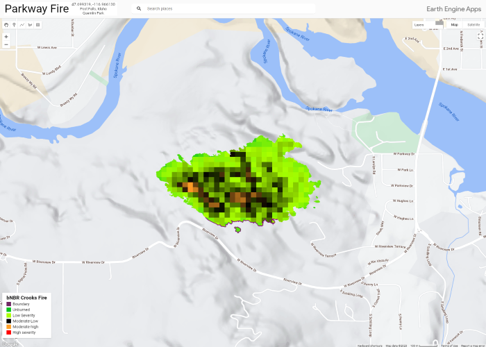
Using Google Earth Engine, Landsat 9, and NIFC open data, I created an application to show the Normalized Burn Ratio (bNBR) of the Parkway Fire. The Parkway Fire began on 8/4/2022 which was located in Post Falls Community Forest (Quemlin Park) in Post Falls, Idaho. The fire is 100% contained which resulted in 80 acres of community forest burnt. An unattended campfire was deteremined the cause of the fire.
Check out some critters found in the Post Falls Community Forest: Quick Capture App
A little information on the LANDSAT collection and images. How to find and consume:
- I personally use Earth Explorer to locate and browse Landsat data
- I'll go to the desired area of interest, set a boundary, and search the Landsat Collection 2 Levels 1 & 2
- Once I find the image I need, Ill extract the information from the title
- In the below example, I needed to replace: "043027_20230803"
- var preFire = ee.Image('LANDSAT/LC09/C02/T1/LC09_043027_20230803');