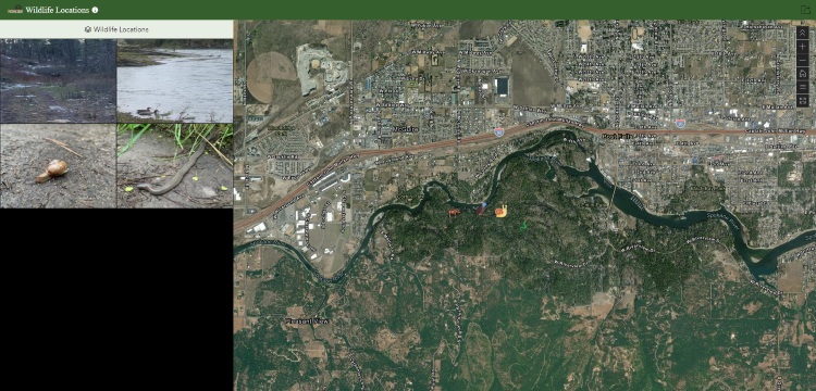
Wildlife Locations | ArcGIS Quick Capture
ArcGIS Quick Capture provides a great way to quickly capture data via mobile device. Setup up is quite easy and once it's up-and-running, it operates as smooth as butter. For all my personal projects, I utilize the ArcGIS for Personal Use license. If you have any questions or you would like assistance staging a project like this, please reach out!
Brief Overview of Methods
- Create a hosted feature layer, and design the schema
- Log into Quick Capture, create and stage a new project | choose "start from existing layers"
- Download app on app store, login and select project
- Capture data
- Create a hosted feature layer view *
- Create a web map, add the hosted feature layer
- Create a web application which is driven by the above web app
*Note: A hosted feature layer view is used to serve the web application. It is necessary to keep the original hosted feature layer private and un-editable by the public.
Wildlife Locations Web Application

Quick Capture Demo
Note: By using the "Other" category, I'm taking a extra step to fill out the species name
The icons I've used are from Flaticon. You can find all the links to the individual authors within the web application and below:
- https://www.flaticon.com/authors/freepik
- https://www.flaticon.com/authors/culmbio
- https://www.flaticon.com/authors/culmbio
- https://www.flaticon.com/authors/chanut-is-industries
- https://www.flaticon.com/authors/bsd
- https://www.flaticon.com/authors/smalllikeart
- https://www.flaticon.com/authors/maxicons
- https://www.yappy.com/us/australiancattledog
Backstory
I hike alot! Rajah forces me to get out and hike. In effort to document some of the wildlife, I decided to stage a Quick Capture project. Quick Capture allows me to take a photo and capture the geolocation of the animal with only a few button clicks. The data is automatically uploaded to my ArcGIS Online account; if I'm offline, it will upload the next time I'm connected to the internet.
